TRUE ELEMENTS WATER INTELLIGENCE SERIES

See what happened, why it mattered, and what to watch next.

Each dated Water Intelligence report connects authoritative water and environmental evidence to investigate a consequential event, explain how the signals relate, preserve uncertainty and limitations, and identify what deserves continued attention.

Three published investigations. Three different places. One disciplined approach to the evidence.

PUBLISHED INVESTIGATIONS

Water Intelligence Reports

Each report examines a defined event and observation period using the evidence available at publication. Read the executive summary on the page, open the approved summary PDF, or request access to the complete report.

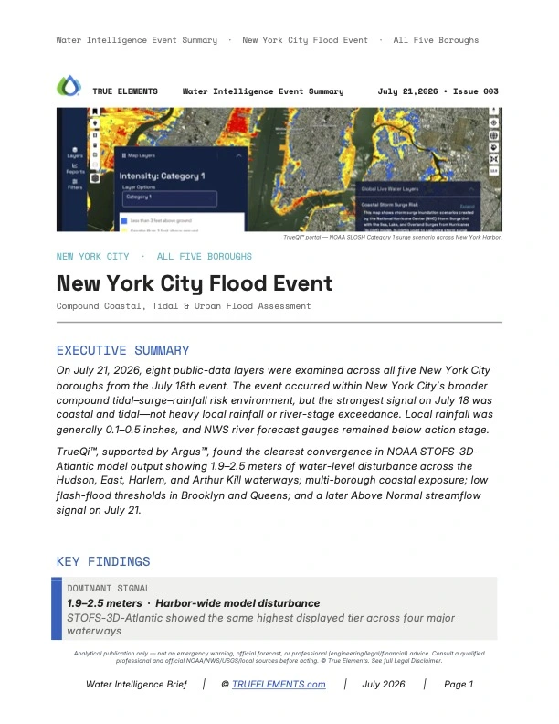
Water Intelligence Brief Issue 003, New York City Flood Event, All Five Boroughs.
WATER INTELLIGENCE BRIEF · ISSUE 003 · JULY 2026

New York City Flood Event

All Five Boroughs
Compound Coastal and Tidal Flood Assessment

Examines eight public evidence layers across all five New York City boroughs. The July 18 analysis found the strongest combined signal in coastal and tidal conditions rather than river-stage exceedance. Modeled harbor disturbance is not observed inundation, and neighborhood impacts require confirmation through observed records.

Open Executive Summary PDF

ISSUE 003 Executive Summary

Executive Summary

On July 18, 2026, eight public-data layers were examined across all five New York City boroughs. The strongest event signal was coastal and tidal (not river-stage exceedance). Local rainfall was generally 0.1-0.5 inches, and NWS river forecast gauges remained below action stage.

TrueQi®, supported by Argus™, found the clearest convergence in NOAA STOFS-3D-Atlantic model output showing 1.9-2.5 meters of water-level disturbance across the Hudson, East, Harlem, and Arthur Kill waterways; multi-borough coastal exposure; low flash-flood thresholds in Brooklyn and Queens; and a later Above Normal streamflow signal on July 21.

Key Findings
Dominant Signal
1.9-2.5 meters · Harbor-wide model disturbance
STOFS-3D-Atlantic showed the same highest displayed tier across four major waterways
River-Stage Contrast
Below Action Stage · Steady trends
NYC-area NWS gauges did not show a conventional river-stage flood condition
Rainfall & Flash-Flood Context
0.1-0.5 inches locally · 1.0-1.5 in/hr FFG in Brooklyn and Queens
Rainfall was modest, but low urban thresholds leave little margin if a stronger cell shifts east
Assessment Status
Dominant coastal and tidal flood threat
Confidence is highest in the mechanism; exact local inundation requires observed confirmation
Data Integration
Authoritative Public Sources
NOAAUSGSNWSFEMA
System Flow
TrueQi®: Multi-source data synthesis
Argus™: Environmental pattern analysis
Operational Understanding: From connected evidence to decision-support intelligence
Better-Informed Decisions
Why This Matters: Connected-Harbor Water Intelligence

Decision relevance came from convergence across an operational coastal model, static exposure layers, rainfall, streamflow, and river-stage status (not a single map). Below-action gauges and modest borough rainfall strengthen the coastal/tidal interpretation. Model output and scenarios are not observed inundation, so local impacts require confirmation.

Operational Assessment: Event Assessment · July 18, 2026

The integration of STOFS-3D-Atlantic harbor-wide disturbance and NWS below-action river gauges isolates the primary threat mechanism as coastal/tidal. Low urban flash-flood guidance in Brooklyn and Queens introduces a secondary compounding vulnerability. Actual inundation extent must be verified through observed records, as models only describe potential disturbance.

TrueQi® integrated eight evidence layers; Argus™ supported comparison. Directional convergence is strong on the coastal mechanism; exact local inundation requires observed confirmation.
About True Elements: Water Intelligence Platform

True Elements' TrueQi® structures environmental-intelligence synthesis. Argus™ supports evidence organization, comparison, and analytical discipline. Together they preserve observations, test convergence, surface operational questions, and make limitations explicit.

Website: trueelements.com

Analytical publication only. It is not an emergency warning, official forecast, or professional (engineering/legal/financial) advice. Consult a qualified professional and official NOAA/NWS/USGS/local sources before acting. © True Elements.
Legal Disclaimer

This report is a water intelligence analysis prepared by True Elements using the TrueQi® Water Intelligence System and Argus™ AI analytics, applying True Elements' proprietary data integration and interpretation methodology, including subject matter covered by U.S. Patent No. US 12,670,407 B2 and pending patent applications. It synthesizes and interprets publicly available third-party data (including NOAA, National Weather Service, FEMA, and USGS sources) as of the stated observation snapshot.

This report does not constitute engineering, hydrological, meteorological, legal, financial, insurance, or other professional advice, and is not a substitute for such advice. It is not an emergency warning, official flood forecast, or regulatory determination, and must not be relied upon as the sole basis for safety, engineering, financial, insurance, legal, or emergency-response decisions. Readers should independently verify all conditions through official NOAA, National Weather Service, USGS, state, and local emergency-management sources, and should consult a licensed engineer, hydrologist, attorney, or other qualified professional before taking any action in reliance on this report.

True Elements makes no representation or warranty, express or implied, as to the accuracy, completeness, timeliness, or fitness for any particular purpose of the information contained in this report, including data obtained from third-party sources. Environmental conditions change rapidly and may have changed materially since the observation snapshot referenced herein. True Elements disclaims all liability for any loss, damage, injury, or claim arising from reliance on this report, to the fullest extent permitted by law.

TrueQi® is a registered trademark of True Elements Inc. Argus™ and AgForward™ are trademarks of True Elements Inc. This report and its methodology are proprietary to True Elements and may not be reproduced or redistributed without permission.

Argus™-generated interpretations are analytical outputs of an AI system and are provided for decision-support purposes only; they are not certified engineering conclusions and remain subject to human expert review.

© 2026 True Elements. All rights reserved.
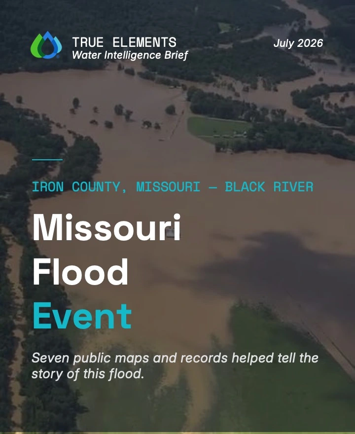
Water Intelligence Brief Issue 002, Missouri Flood Event, Iron and Reynolds Counties, Missouri.
WATER INTELLIGENCE BRIEF · ISSUE 002 · JULY 2026

Missouri Flood Event

Iron and Reynolds Counties, Missouri
Flood Analysis

Examines seven public evidence layers across Iron and Reynolds Counties in a source-described 1,000-year flood event. The investigation connects watershed-scale conditions while keeping missing gauge data, unconfirmed inundation extent, and other material limitations explicit.

Open Executive Summary PDF

ISSUE 002 Executive Summary

Executive Summary

From July 6-20, 2026, seven public-data layers were examined across Iron and Reynolds Counties, Missouri, including the Black River watershed and West Fork Black River drainage basin. The finalized Full Report classifies the event as a 1,000-year flood event (0.1% annual exceedance probability), while preserving material gaps in named-gauge readings, the Iron County Flood Hazard Outlook probability overlay, and actual inundation extent.

TrueQi®, supported by Argus™, found the strongest convergence in county-wide above-normal flow across every visible Iron County stream reach, 2.0-2.5-inch one-hour Flash Flood Guidance during the active event, mapped 100- and 500-year flood-hazard structure, no visible comparable event cluster in the 1950-2021 viewport, and a national Flood Hazard Outlook discussion dated July 20.

Key Findings
Network Status
County-wide above-normal flow
Every visible Iron County stream reach carried the same directional signal
Flash-Flood Resistance
2.0 to 2.5 inches · One-hour guidance
Model-derived threshold captured during active flooding; not a guarantee flooding will occur
Structural Context
Mapped 100- and 500-year hazard zones
Actual inundation was not mapped; the finding is recurrence-based context
Assessment Status
1,000-year flood event · 0.1% annual exceedance probability
Confidence is highest in directional convergence; exact magnitude and extent require confirmation
Data Integration
Authoritative Public Sources
NOAAUSGSNWSFEMA
System Flow
TrueQi®: Multi-source data synthesis
Argus™: Environmental pattern analysis
Operational Understanding: From connected evidence to decision-support intelligence
Better-Informed Decisions
Why This Matters: Watershed-Scale Water Intelligence

Decision relevance came from convergence across connected stream reaches, current trigger guidance, mapped hazard structure, historical context, and national coordination (not a single gauge). Confidence is highest in the directional signal. Named-gauge stage and discharge, Flood Hazard Outlook polygons, and actual inundation were unavailable, so magnitude, timing, and extent require post-event confirmation.

Operational Assessment: Event Assessment · July 6-20, 2026

Every visible Iron County reach showed above-normal flow. One-hour Flash Flood Guidance was 2.0 to 2.5 inches during active flooding. FEMA mapped 100- and 500-year zones. The historical viewport showed no visible comparable cluster, and a July 20 national Flood Hazard Outlook discussion remained active. Missing gauge markers may reflect disruption or zoom/rendering; the cause was not determined.

TrueQi® integrated seven evidence layers; Argus™ supported comparison. Directional convergence is strong; magnitude, inundation extent, and missing gauges require confirmation.
About True Elements: Water Intelligence Platform

True Elements' TrueQi® structures environmental-intelligence synthesis. Argus™ supports evidence organization, comparison, and analytical discipline. Together they preserve observations, test convergence, surface operational questions, and make limitations explicit.

Website: trueelements.com

Analytical publication only. It is not an emergency warning, official forecast, or professional (engineering/legal/financial) advice. Consult a qualified professional and official NOAA/NWS/USGS/local sources before acting. © True Elements.
Legal Disclaimer

This report is a water intelligence analysis prepared by True Elements using the TrueQi® Water Intelligence System and Argus™ AI analytics, applying True Elements' proprietary data integration and interpretation methodology, including subject matter covered by U.S. Patent No. US 12,670,407 B2 and pending patent applications. It synthesizes and interprets publicly available third-party data (including NOAA, National Weather Service, and USGS sources) as of the stated observation snapshot.

This report does not constitute engineering, hydrological, meteorological, legal, financial, insurance, or other professional advice, and is not a substitute for such advice. It is not an emergency warning, official flood forecast, or regulatory determination, and must not be relied upon as the sole basis for safety, engineering, financial, insurance, legal, or emergency-response decisions. Readers should independently verify all conditions through official NOAA, National Weather Service, USGS, state, and local emergency-management sources, and should consult a licensed engineer, hydrologist, attorney, or other qualified professional before taking any action in reliance on this report.

True Elements makes no representation or warranty, express or implied, as to the accuracy, completeness, timeliness, or fitness for any particular purpose of the information contained in this report, including data obtained from third-party sources. Environmental conditions change rapidly and may have changed materially since the observation snapshot referenced herein. True Elements disclaims all liability for any loss, damage, injury, or claim arising from reliance on this report, to the fullest extent permitted by law.

TrueQi® is a registered trademark of True Elements Inc. Argus™ and AgForward™ are trademarks of True Elements Inc. This report and its methodology are proprietary to True Elements and may not be reproduced or redistributed without permission.

Argus™-generated interpretations are analytical outputs of an AI system and are provided for decision-support purposes only; they are not certified engineering conclusions and remain subject to human expert review.

© 2026 True Elements. All rights reserved.
Water Intelligence Brief Issue 001, Guadalupe River Flooding, Kerrville, Texas.
WATER INTELLIGENCE BRIEF · ISSUE 001 · JULY 2026

Guadalupe River Flooding

Kerrville, Texas
Flash Flooding

Examines four public data products describing measured river stage, network streamflow, forward flood hazard, and rainfall-trigger sensitivity near Kerrville. The dated investigation explains how the signals relate while preserving forecast, threshold, and observation limitations.

Open Executive Summary PDF

ISSUE 001 Executive Summary

Executive Summary

In the early morning hours of July 5, 2026, four independent real-time environmental datasets converged on a single operational picture: the Guadalupe River at Kerrville, Texas had entered moderate flood stage at 13.74 feet, significantly above the established 11-foot flood threshold.

By synthesizing live stream gauge readings, streamflow anomaly data, Flash Flood Guidance thresholds, and Flood Hazard Outlook information, TrueQi® and Argus systems identified conditions where as little as 0.25 inches of rainfall within a single hour could trigger additional flash flooding across an already saturated watershed.

Key Findings
River Stage
13.74 ft · Moderate Flood Stage
25% above the 11-foot threshold at the Kerrville gauge
Critical Rainfall Threshold
< 0.25″ per hour may trigger additional flash flooding
Soils fully saturated. Even small rainfall events carry elevated risk.
Watershed Status
Exceptional hydrologic stress
Streamflows well above seasonal norms across Kerr County
Flash Flood Risk Level
Elevated · Ongoing · Additional rainfall expected
All four independent data sources aligned on the same operational picture
Data Integration
Authoritative Public Sources
NOAAUSGSNWISNWS
System Flow
TrueQi®: Multi-source data synthesis
Argus™: Environmental pattern analysis
Operational Understanding: From connected evidence to decision-support intelligence
Better-Informed Decisions
Why This Matters: Real-Time Water Intelligence

The Guadalupe River at Kerrville is a well-documented flash flood corridor. What this event demonstrates is the operational value of synthesizing multiple authoritative public data streams into a unified environmental picture. Stream gauge readings, streamflow anomalies, flash flood guidance thresholds, and flood outlook data are independently informative. Together, they are operationally decisive.

Operational Assessment: Current Conditions · July 2026

The Guadalupe River entered moderate flood stage at 13.74 feet (25% above the 11-foot threshold). Streamflows are well above seasonal norms. Soils are fully saturated across the watershed. Even sub-quarter-inch hourly rainfall accumulations carry meaningful flash flood potential until conditions normalize.

TrueQi® synthesized four independent data sources into a unified environmental picture. Argus identified the critical rainfall threshold: 0.25 inches per hour. The result: operational clarity in real time, not raw data.
About True Elements: Water Intelligence Platform

True Elements synthesizes authoritative public datasets into operational environmental understanding. TrueQi® aggregates multi-source data. Argus identifies environmental patterns. Together they convert raw sensor readings into decisive intelligence.

Analytical publication only. It is not an emergency warning, official forecast, or professional (engineering/legal/financial) advice. Consult a qualified professional and official NOAA/NWS/USGS/local sources before acting. © True Elements.
Legal Disclaimer

This report is a water intelligence analysis prepared by True Elements using the TrueQi® Water Intelligence System and Argus™ AI analytics, applying True Elements' proprietary data integration and interpretation methodology, including subject matter covered by U.S. Patent No. US 12,670,407 B2 and pending patent applications. It synthesizes and interprets publicly available third-party data (including NOAA, National Weather Service, and USGS sources) as of the stated observation snapshot.

This report does not constitute engineering, hydrological, meteorological, legal, financial, insurance, or other professional advice, and is not a substitute for such advice. It is not an emergency warning, official flood forecast, or regulatory determination, and must not be relied upon as the sole basis for safety, engineering, financial, insurance, legal, or emergency-response decisions. Readers should independently verify all conditions through official NOAA, National Weather Service, USGS, state, and local emergency-management sources, and should consult a licensed engineer, hydrologist, attorney, or other qualified professional before taking any action in reliance on this report.

True Elements makes no representation or warranty, express or implied, as to the accuracy, completeness, timeliness, or fitness for any particular purpose of the information contained in this report, including data obtained from third-party sources. Environmental conditions change rapidly and may have changed materially since the observation snapshot referenced herein. True Elements disclaims all liability for any loss, damage, injury, or claim arising from reliance on this report, to the fullest extent permitted by law.

TrueQi® is a registered trademark of True Elements Inc. Argus™ and AgForward™ are trademarks of True Elements Inc. This report and its methodology are proprietary to True Elements and may not be reproduced or redistributed without permission.

Argus™-generated interpretations are analytical outputs of an AI system and are provided for decision-support purposes only; they are not certified engineering conclusions and remain subject to human expert review.

© 2026 True Elements. All rights reserved.

A TRACEABLE ANALYTICAL RECORD

The conclusion matters. So does the evidence behind it.

Conditions continue to change after an event. Each Series issue preserves the evidence and reasoning associated with a defined publication period so readers can understand what was known, what was inferred, what remained uncertain, and what required confirmation.

DEFINED EVENT AND TIME PERIOD

Identify the event date, observation snapshot, or analysis period addressed by the report.

SOURCE RECORD

Identify the public and appropriately licensed evidence examined in the investigation.

EVIDENCE-TYPE CLARITY

Distinguish measurements, modeled scenarios, forecasts, historical comparisons, and True Elements interpretation.

FINDINGS AND RELATIONSHIPS

Explain what the combined evidence indicates and how the relevant signals relate.

LIMITATIONS AND UNCERTAINTY

Retain missing observations, source constraints, timing differences, confidence boundaries, and required confirmation.

WHAT TO MONITOR NEXT

Identify the evidence, conditions, or relationships that deserve continued attention after publication.

Evidence should remain examinable, even after the conditions have changed.

REPEATABLE INVESTIGATION

Different events. One disciplined way to investigate them.

The locations, conditions, and evidence change from report to report. The investigation follows the same essential discipline so findings can be examined, challenged, and understood in context.

01
FRAME THE EVENT

Define the place, time period, water system, and question the investigation must address.

02
CONNECT THE EVIDENCE

Bring together the relevant observations, forecasts, models, maps, historical records, and contextual sources.

03
INVESTIGATE THE RELATIONSHIPS

Examine how the signals interact across physical systems, geography, time, infrastructure, and affected communities.

04
PRESERVE THE RECORD

Publish the findings with their sources, assumptions, uncertainty, limitations, and monitoring outlook intact.

Physics-informed modeling. Integrated environmental science. Advanced reasoning.

TrueQi® constructs the Water Intelligence context. Argus™ supports investigation within it. The published report preserves the evidence, findings, and boundaries for human review.

HOW TO READ THE REPORTS

Findings should be useful without pretending uncertainty disappeared.

Each Series issue uses evidence available for a stated observation or publication period. Sources may differ in purpose, geographic resolution, update schedule, methodology, and confidence.

The reports distinguish measured observations, modeled conditions, forecasts, third-party information, and True Elements interpretation wherever those distinctions affect meaning. They also state material gaps, limitations, and where current official information or qualified professional review remains necessary.

SOURCE

Where did the evidence originate?

TIME

What date, observation period, or forecast period applies?

EVIDENCE TYPE

Is the information measured, modeled, forecast, historical, or interpreted?

LIMIT

What remains uncertain, incomplete, or subject to confirmation?

DIFFERENT QUESTIONS. DIFFERENT FORMS OF WATER INTELLIGENCE.

Continue with the evidence that matches what you need to understand.

DATED EVENT INVESTIGATIONS

Examine a defined event through its publication-period evidence, findings, uncertainty, limitations, and monitoring outlook.

View the Reports
ACTIVELY UPDATED REGIONAL INTELLIGENCE

Explore changing conditions and related context across a regional water system as its source information is updated.

Explore the Water Observatory
YOUR ORGANIZATION’S QUESTION

Apply the same Water Intelligence capability to a specific geography, water system, operation, asset, investment, infrastructure responsibility, supply chain, or client need.

Explore Water Resource Intelligence
WATER INTELLIGENCE SERIES, CLEARLY DEFINED

Questions people ask about the Water Intelligence Series.

APPLY WATER INTELLIGENCE

Bring us the event, place, or water system your organization needs to understand.

We’ll show you the evidence and relationships your team can investigate, what the available information supports, where uncertainty remains, and what deserves attention next.

Water Intelligence Series reports are dated analytical publications prepared using public and appropriately licensed third-party information, True Elements’ Water Intelligence methodology, and AI-supported analysis. They are not emergency warnings, official forecasts, regulatory determinations, or substitutes for engineering, hydrological, meteorological, legal, financial, insurance, emergency-management, or other qualified professional advice. Environmental conditions may have changed after the stated observation period. Verify consequential decisions through current official sources and qualified professionals.