See a changing water system in one connected view.
The Water Observatory brings authoritative data, modeled relationships, reporting, and regional context together so people can understand current conditions, related impacts, uncertainty, and what to watch next.
The Colorado River Basin is the first available regional experience.
The data exists. The understanding is scattered.
Public agencies, researchers, and other authoritative sources publish essential observations, forecasts, maps, and models. Those sources are often separated by geography, time, format, and purpose. The Water Observatory brings the relevant evidence into one regional context so people can see how conditions relate, where uncertainty remains, and what deserves attention next.
More data is not the answer. Seeing what it means together is.
Bring together authoritative environmental signals.
Examine relationships across sources, places, systems, and time.
Explain what the combined evidence indicates in practical context.
Distinguish observations, models, forecasts, limitations, and uncertainty.
Colorado River Basin
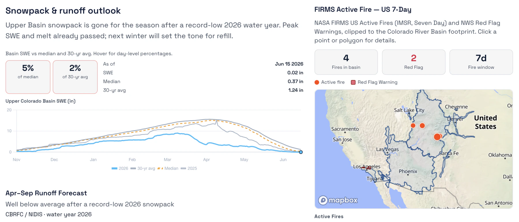
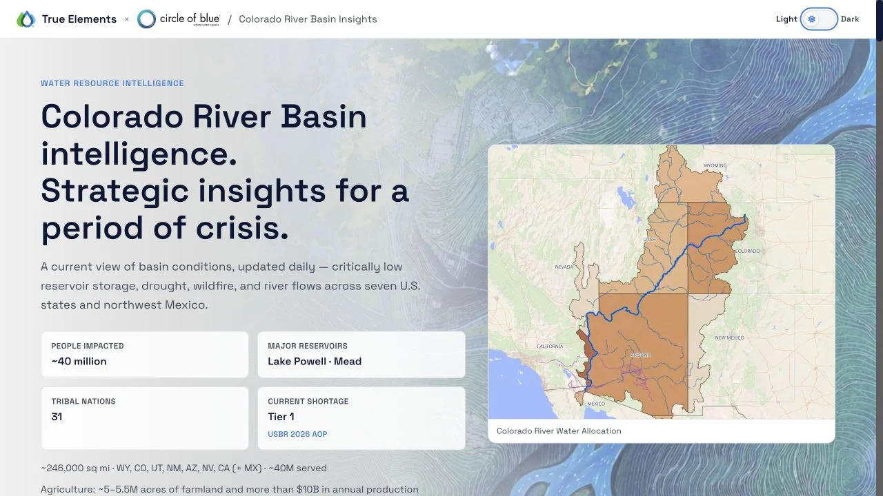
Explore one regional view connecting reservoir storage, drought, snowpack, runoff, streamflow, fire conditions, shortage status, infrastructure, communities, and economic activity across the water system they share.
Update timing varies by source. The regional experience identifies the applicable observation date, reporting period, forecast period, or latest available update.
Decision-support intelligence, not an emergency warning or official forecast. Verify current conditions through the linked government and local authorities.
See the signals surrounding the questions people need to answer.
The relevant evidence depends on the region and the question. In the Colorado River Basin experience, visitors can examine conditions that are often encountered separately.
RESERVOIR STORAGE AND SHORTAGE STATUS
Examine reported storage conditions, operating context, and shortage information across the basin.
DROUGHT AND CLIMATE CONDITIONS
See drought indicators and relevant climate conditions in the regional context surrounding them.
SNOWPACK AND RUNOFF
Compare available snowpack and runoff information that helps explain changing water supply conditions.
STREAMFLOW
Review streamflow observations and their place within the larger basin system.
FIRE CONDITIONS
Connect active fire and red flag conditions with the watersheds and communities around them.
INFRASTRUCTURE AND WATER USE
Examine major reservoirs, infrastructure, water uses, and shared dependencies within one regional view.
COMMUNITIES AND ECONOMIC CONTEXT
Understand the people, Tribal Nations, jobs, and economic activity connected to the basin without reducing the region to one environmental score.
These are representative areas of investigation, not the limits of the Water Intelligence System.
Understanding begins with evidence and includes its limits.
Trust does not come from hiding uncertainty. It comes from making the evidence, timing, methods, and limits available for review.
TRACE THE SOURCE
Identify where each observation, forecast, model, map, threshold, or other evidence product originated.
PRESERVE TIME
Show the applicable observation date, reporting period, forecast period, or latest available update.
SEPARATE EVIDENCE TYPES
Distinguish measured conditions from modeled scenarios, forecasts, third-party analysis, and True Elements interpretation.
STATE THE BOUNDARY
Identify uncertainty, missing evidence, source limitations, and where independent verification or qualified professional review remains necessary.
The Observatory does not simply display signals. It investigates how they relate.
A conventional dashboard can organize measurements and visualizations. The Water Observatory adds the Water Intelligence context required to examine relationships across the physical system, environmental conditions, place, time, and human consequences.
PHYSICS-INFORMED MODELING
Represents relevant water movement, balance, continuity, and physical relationships within the regional system being examined.
INTEGRATED ENVIRONMENTAL SCIENCE
Connects hydrology, hydrography, meteorology, land, water quality, infrastructure, and other relevant environmental context.
ADVANCED REASONING
Helps direct investigation across the connected evidence, organize findings, and keep supporting sources and model outputs available for review.
TrueQi® constructs the Water Intelligence context. Argus™ supports investigation within it. Qualified experts and responsible authorities remain accountable for interpretation, decisions, and action.
The Water Observatory connects relevant evidence from authoritative public and appropriately licensed sources using True Elements’ Water Intelligence methodology and AI-supported analysis. Source products may differ in purpose, geographic resolution, observation time, forecast period, methodology, and update schedule. The Observatory distinguishes measured observations, modeled conditions, forecasts, third-party information, and True Elements interpretation wherever those distinctions affect meaning.
Regional intelligence is a time-bounded analytical view of the latest available evidence. It does not guarantee current field conditions, eliminate uncertainty, or replace official warnings, regulatory determinations, emergency guidance, or qualified professional advice.
Continue with the view that matches what you need to understand.
ACTIVELY UPDATED REGIONAL INTELLIGENCE
Explore changing conditions and related context across a defined regional water system as its source information is updated.
Open the Colorado River Basin ObservatoryDATED EVENT INVESTIGATIONS
Examine evidence-led investigations that preserve a defined observation period, source record, findings, limitations, and monitoring outlook.
Explore the Water Intelligence SeriesORGANIZATIONAL QUESTIONS
See how organizations apply the same Water Intelligence capability to operations, assets, investments, infrastructure, supply chains, and client work.
Explore ApplicationsQuestions people ask about the Water Intelligence Observatory.
Bring us the region or water system your organization needs to understand.
Whether the question begins with changing conditions, infrastructure, operations, communities, assets, or investment, we’ll show you the connected evidence and relationships your team can investigate next.
The True Elements Water Intelligence Observatory provides analytical decision support using public and appropriately licensed third-party data, True Elements’ proprietary Water Intelligence methodology, and AI-supported analysis. It is not an emergency warning service, official forecast, regulatory determination, or substitute for qualified professional advice. Environmental conditions and source data may change after the stated observation time. Verify consequential decisions through current official sources and qualified professionals.
Review Methodology and Limitations